When Austin city staff were asked to explain why they recommended rezoning the old Rosedale School site to allow 435 high-density apartments, they cited six recent “comparable” rezoning cases that boosted residential density. Each sailed through the city council in 2025 on unanimous votes.
On closer examination, the comps are not compy. All increased density, but otherwise they differ significantly from Rosedale’s case. Instead of showing Rosedale is getting the same treatment as other rezonings, they underscore how its case is unique.
Here’s how:
- There is no comparable case in which high-density development is wedged into the interior of a single-family neighborhood.
Every comp that planners cited showed the existing property already touched commercial or existing medium-to-high density residential on three or more sides. In Rosedale, it’s the opposite: Single-family homes on small lots directly adjoin the north Austin property on three sides.
- There is no comparable case in which rezoning leaped from single-family zoning to high-density residential zoning.
The other properties began in a more-dense zoning category — usually commercial or a medium-density multifamily zoning. Their rezoning cases just took the intensity up a single step. In Rosedale, the proposed rezoning jumps straight from single-family to high-density apartments, skipping past medium-density zoning categories in between.
- In nearly all cases, the comps were on private land being converted to another private use. The old Rosedale School rezoning would convert publicly-owned school property to private hands.
The most notable exception: the Anita Ferales Coy facility, which the Austin Independent School District retains ownership of and leases to a developer. With Coy, the parties took in community input and jointly came up with that plan that incorporates affordable housing for teachers, parkland, and other community assets. With Rosedale, also owned by AISD, the district discarded similar community input and went with a sale to a private developer of luxury apartments.
- There is no comparable case that lacks affordable housing.
In all the other cases, an affordable housing element was included.
Rosedale vs. the ‘comps’
The images below, from Google Earth, show the Rosedale and the other “comparable” residential development properties, what surrounds them, and how traffic flows from them.
They are excerpts from a pair of larger reports prepared by members of Play Fair With Rosedale:
- Austin Rezoning Comps (aerial views of comps, plus neighborhood photo comparisons); and
- Detailed rezoning maps, showing the same comps on Austin zoning maps
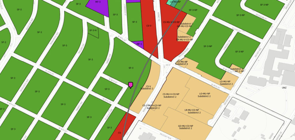
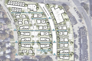
Rosedale School, 2117 W. 49th St.
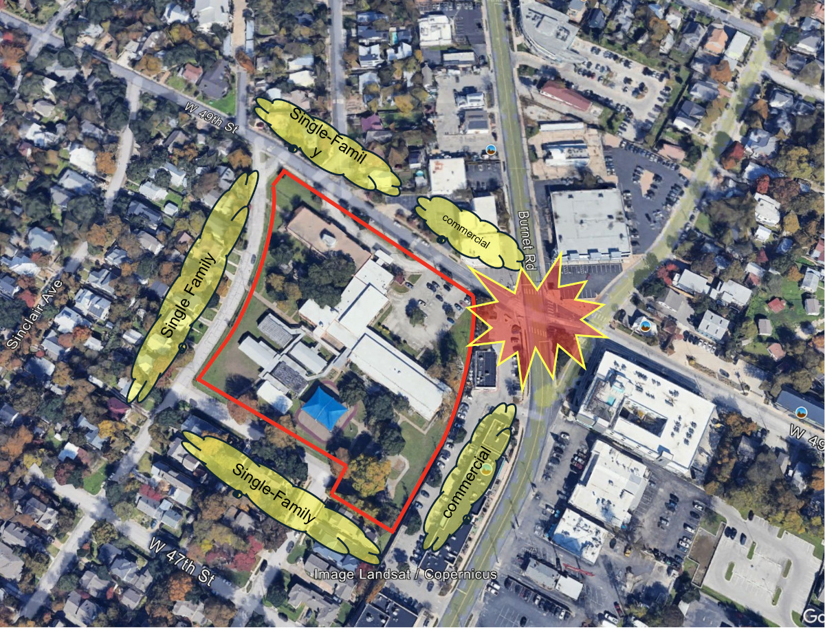
| 435 units 94 units per acre No direct access to Burnet Road Traffic forced to cut through residential streets; problem intersection at 49th and Burnet Surrounded by single family on 3 sides, commercial on east Current zoning: Single family |
2130 Goodrich Ave.
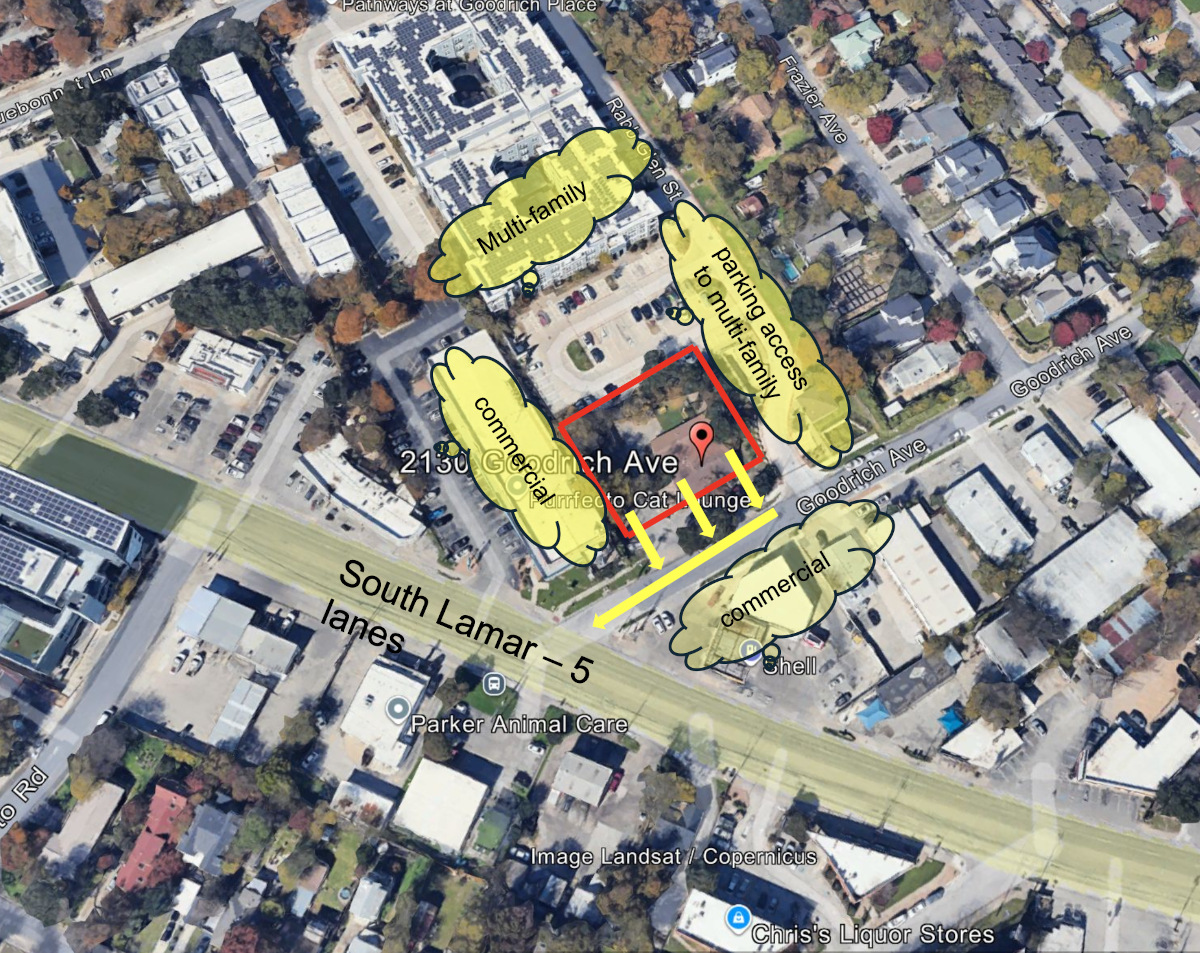
| 55 units 130 units per acre Direct access to South Lamar Boulevard Surrounded by commercial and multifamily No traffic cut-through on residential streets Previously zoned commercial/mixed use |
Brentwood Multifamily, 5401 Burnet Rd.
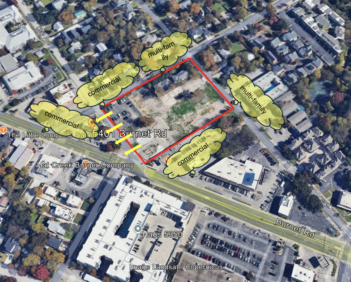
| 375 units 126 units per acre Direct access to Burnet Surrounded 3 sides by commercial and multifamily No traffic cut-through directed onto neighborhood streets Previously zoned commercial/mixed use |
Oak Creek Village, 2302 Durwood St.
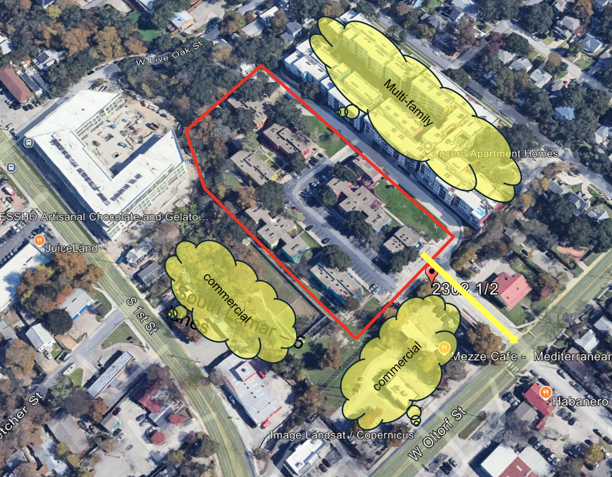
| 425 units 85 units per acre Direct access to Oltorf Street No traffic cut-through residential streets Surrounded by commercial and multifamily Previously zoned multifamily |
1430 Collier St.
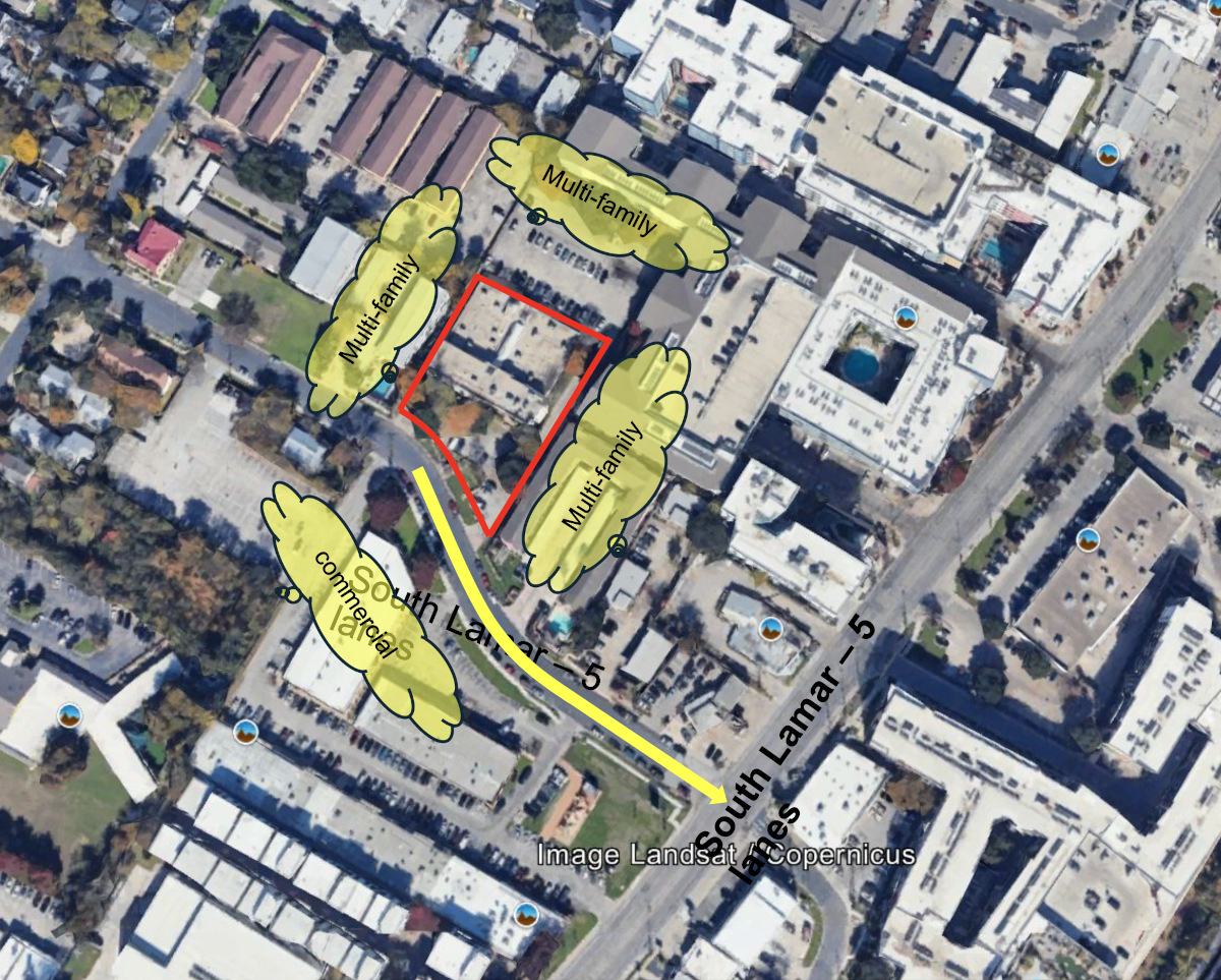
| 187 units 105 units per acre Access from Collier Street through commercial properties to South Lamar Boulevard No traffic cut-through residential streets Surrounded by commercial and multifamily Previously zoned multifamily |
2313 Thornton Rd.
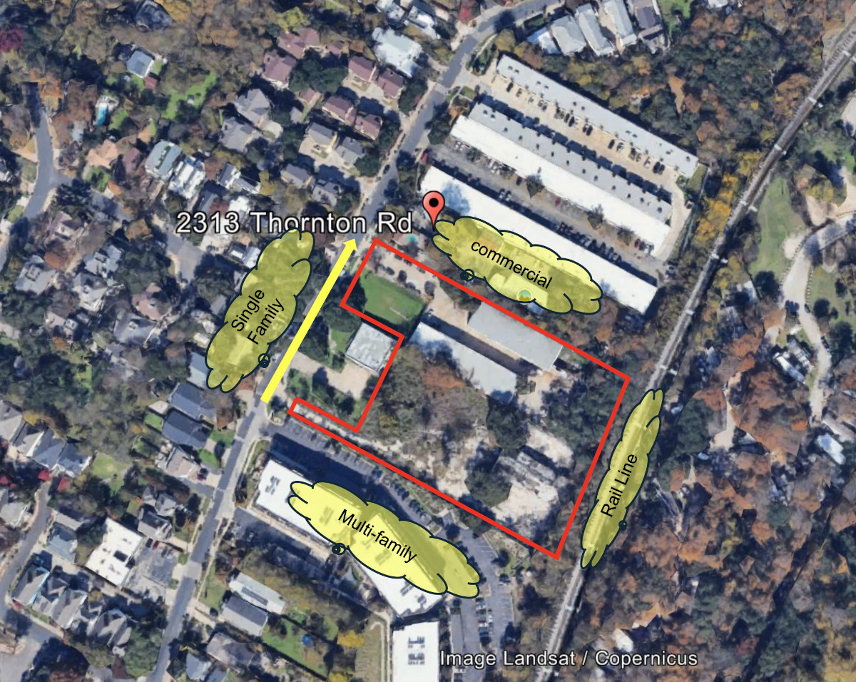
| 350 units 83 units per acre Difficult access to West Oltorf Street via Thornton Road Traffic forced onto residential streets; city acknowledges negative impact Surrounded by commercial, multifamily, single family and industrial Previously zoned industrial |
Anita Ferales Coy, 4300 Gonzales St.
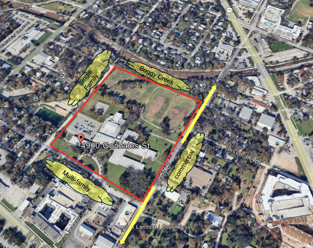
| 684 units 36 units/acre Access via Shady Lane to Airport Boulevard or E. 7th Street No traffic cut-through residential streets Surrounded by commercial, multifamily, single family and park land Previously zoned P-NP (public, neighborhood plan) |
Take a deeper dive into the Rosedale zoning map and compare it to other recent Austin upzonings.
0 Comments