Austin’s analysis underestimates impact on neighborhood streets, say experts
When done right, developments plan for the additional traffic they’ll create, and minimize its impact on existing neighborhood streets.
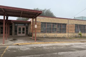
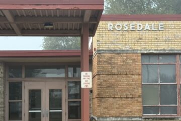
The proposed Rosedale School redevelopment fails on both counts.
Who says so? We do. We are Kathy Fretwell and Scott Morledge, and we bring to the table our years of experience as a civil engineer (Kathy) and a green developer (Scott). We have families who live in Rosedale and enjoy how walkable and welcoming to families it is.
We have looked at the proposal for development of the former Rosedale School site. We’ve come away deeply concerned about how much traffic this high-density luxury apartment complex would dump onto the neighborhood’s narrow streets. The impact will be large, the mitigation effort is tiny, and the planning has been flawed.
The cursory traffic analysis the city performed contains obvious errors that understate impact. When Austin planning staffers look at a rezoning, they have two levels of analysis. They performed the less-thorough one, called a Neighborhood Traffic Analysis (NTA). A more rigorous study, called a Traffic Impact Analysis (TIA), is a full-scale engineering study required for large developments that generate more than 2,000 vehicle trips per day.
Respectfully, we question the assumptions in their NTA, which conveniently knocks down the projected traffic impact to a level where they say a larger TIA study isn’t needed. Their analysis mischaracterized the site as an administrative office, a category that their charts say will generate 489 vehicle trips per day. Obviously, a vacant school doesn’t generate traffic.
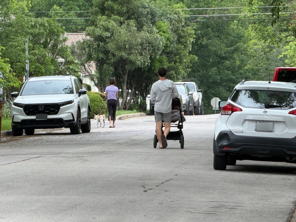
The Rosedale neighborhood surrounding the school is now highly walkable, and the traffic load is light enough for cars, bicycles, dog walkers and baby strollers to co-exist. It will be less walkable and more dangerous if this development moves forward.
The big reason: It has narrow (26 or 27 feet wide) streets, and few sidewalks. We’ve been told by proponents of high-density building that traffic congestion is good for us, that walking in the streets with more cars is somehow safer than walking in the streets with fewer cars. That makes no sense. More traffic means more minor collisions, traffic stress, and delays for emergency services.
Roadways without sidewalks are more than twice as likely to have pedestrian crashes
as sites with sidewalks on both sides of the street, according to the Federal Highway Administration. The presence of the Texas School for the Blind and Visually Impaired, just over 1/4 of a mile from the proposed development, adds to the need for planning this development with pedestrians in mind.
The developer proposes to make only minimal traffic improvements. OHT Partners offers to build a few feet of sidewalks immediately adjacent to their building, leading from the massive building to bus stops on Burnet Road. That’s nice if you live in the building, but useless to the neighborhood. OHT also offers to build a single speed bump on 49th Street.
By any analysis, these are meager efforts. Yet these efforts are enough, in the city’s analysis, to win a 20 percent reduction in projected traffic counts.
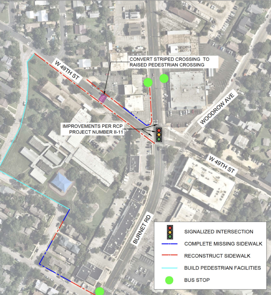
The intersection of 49th Street and Burnet Road is a narrow choke point. It is on a blind-curve with complex issues that will resist improvement. There isn’t enough room to add a left turn lane on Burnet or on 49th at the intersection without widening and realigning the road. Any such widening of the intersection, is complicated by a new law office on the north side and the existing restaurant on the south side. Those businesses depend on that parking.
Residents already know the intersection is clogged, and avoid it. Yet the city’s analysis projects that 70 percent of traffic from the development will flow onto 49th Street and to this intersection. Just 30 percent is projected to go to Ramsey Avenue.
That defies logic and experience. The intersection is on the north side of the development. Access to MoPac and downtown lie to the south. Anyone commuting to work or shopping downtown will learn to avoid the choke point and drive on neighborhood streets instead.
There are no plans for improving the intersection as part of the development. Any traffic impact fees the developer will pay go into a pot of money for traffic improvements in the area, not toward solving the problems this specific development will create, which are likely to require tens of millions of dollars to construct.
| Rosedale development traffic: Assumptions vs. reality | ||
|---|---|---|
| City says | The reality | |
| Existing daily traffic (vehicle trips/day) | 489 | Nothing on most days |
| Increase in daily traffic when developed | 1,091 | More than 2,000* |
| Number of exits from site | 2 | 3 |
| Where traffic from development will flow | City states 70% will flow to 49th St., and to the traffic light at 49th and Burnet Road | The intersection is a choke point, and its traffic light cannot handle an increase in traffic flow. Vehicles will mostly flow through to neighborhood. |
| Source for city data: Rosedale School Neighborhood Traffic Analysis (NTA) *Per Institute of Transportation Engineers (11th Edition) Trip Generation Manual, for apartments 3-10 stories (without reduction for future light rail at 38th Street, and assumption for apartment residents reducing vehicle trips by walking on new proposed sidewalks next to the development). | ||
The city’s traffic analysis ignored an additional 795 vehicles per day that currently use Woodview, Shoalwood and Sinclair to drive to 49th Street and Lynnwood. With this addition, 49th Street will exceed maximum operational capacity (as defined in the national standard, “Highway Capacity Manual”) by almost 1,200 vehicles per day!
The significant additional traffic and on-street parking generated by a 435-unit apartment project will impact fire and EMS service to Rosedale. The fire station at the corner of Lynnwood and Hancock will struggle to navigate neighborhood streets to answer emergency calls in the area.
Take a deeper dive: Read Scott Morledge’s Annotated version of Austin’s traffic analysis
Solutions
- The best solution is to deny this rezoning.
It is an unprecedented intrusion in Austin of a high-density development in a single-family neighborhood. A smaller-scale development would reduce the traffic impacts to a level the neighborhood can safely absorb.
If the city does want to move forward with rezoning, it needs to wait until it has more information.
- We urge the city to perform a full Traffic Impact Analysis.
The roads in this area are not adequate to handle the volume of trips per day this site will generate on our residential streets.
It is clear residents will not use the light at 49th Street and Burnet Road without improvements. These improvements should be required by the developer and not addressed with street impact fees – money that goes into a generic pot.
In short, there are no good choices if this rezoning and redevelopment plan goes forward as is. The high volume of traffic it will generate will overwhelm the local infrastructure and hurt local businesses. A full traffic study is needed.
What a full Traffic Impact Analysis should do
A full Traffic Impact Analysis study should:
- Include a full traffic count of all impacted neighborhood streets and at the constricted 49th Street/Burnet Road intersection.
- Evaluate existing neighborhood traffic patterns to determine current levels of service.
- Quantify the new trips generated by the project and how those trips affect the transportation network.
- Calculate the weekday morning and afternoon peak demands, including evaluation of site access points, the adjacent roadways, and key intersections.
- Simulate traffic and scenarios for current and future scenarios including delays, level of service, and queue lengths.
- Evaluate all alternatives to getting traffic from this development site and determine additional transportation needs to maintain a satisfactory level of service.
Any rezoning should be conditioned on substantial traffic safety measures, and any impact fees should be dedicated to improvements caused by this development, not put into a bucket for improvements later or elsewhere in Austin.
At the March 17 Zoning and Platting Commission meeting, the transportation planner who addressed our concerns stated that after the site is built, if the traffic overloads the roads, that’s when they will take steps to make improvements. At this point the developer will have moved on and the City of Austin will be asking for transportation bonds from the citizens of Austin to fund this intersection construction.
In other words, once it’s broken, they’ll consider looking at fixes.
Here’s an alternative idea: Don’t break it.

 | Kathy Fretwell, P.E. is a licensed civil engineer in Texas with 33 years of experience in design and project management for a wide range of projects for municipalities across Texas and the western U.S. ranging in construction value up to $170 million. |
 | Scott Morledge, recently retired from a 40-year career in the real estate development industry in Austin, specializing in residential, retail and medical office projects. |
0 Comments